Jayne hiking Jayne hiking Jayne hiking Jayne hiking
 
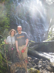
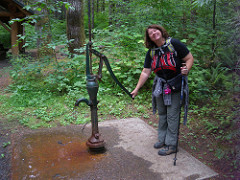
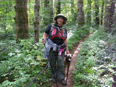
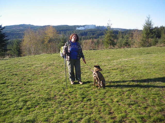
Beautiful Day Hikes & Camping
near Forest Grove, Oregon
(emphasis on dog-friendly places)
 

Follow me on Twitter @coyotebroad: My tweets are about travel, motorcycling, tent camping, bicycling (mostly as a commuter), and things I find amusing.

disclaimer

I created this page primarily for me, and for friends coming to visit me. There are many books and web sites about hikes and camping in the area - though I've never found a book that lists even most of the hikes I've listed below.

Camping in Oregon is wonderful - but it is also so popular that it can be difficult to do in certain areas without reservations months in advance. And as state forests and many national forests don't take camping reservations - and that's most of the camp sites between PDX and the coast - it can be even more difficult; for instance for any holiday weekend, where the holiday is on Monday, you will not be able to camp at any camp site that doesn't take reservations within a half day's drive of Portland, unless you get to the camp site and set up a tent by WEDNESDAY. I'm not kidding. For an in-season weekend, such camp sites are often filled by noon on Friday. 

Hiking around the area is also a challenge: there are few loops, meaning most hiking means you go in one direction, get to an end point, and you turn around and come back. And the trails are either super easy or hugely challenging - there is rarely an in-between.

These are the resources I use to find hiking and camping in the area:

Oregonhikers.org. You have to be careful with this, however, because some of the hikes are through urban areas, along golf courses and on sidewalks through condos - they are trails only in the mind of the person that submitted the "trail." This is a great site for reviews.

Give yourself at least an hour to get to any of these from Forest Grove (90 minutes is better). Note that Sunday afternoon and evening traffic back to Forest Grove is nightmarish, as everyone heads back from the Coast.

Tillamook State Forest Recreation
 
TSF Recreation Guide
 
Additional Tillamook State Forest Recreation Information
 
Tillamook State Forest Trails

Clatsop State Forest Trails Saddle Mountain, 5.2 miles in and out
Highest point in northwest Oregon, this saddle-shaped peak commands a panorama from the ocean to the truncated cone of Mt. St. Helens. From Portland, take Highway 26 west for 60 miles, and turn north just before milepost 10 onto Saddle Mountain Road. Go 7 miles on this paved, but bumpy road where it ends at the trailhead. Can be crowded on weekends. There are some walk-in campsites available at the trailhead for 9$ per night.
 
Our Lady of Guadalupe Trappist Abbey, 4 miles round trip (in and out)
9200 NE Abbey Road, Carlton. Hike is an old road that climbs through an oak savannah to a hilltop shrine with a view across the Willamette Valley. The wooded grounds of the monastery of Our Lady of Guadalupe are open to respectful visitors. Hikers are asked to speak quietly, bring no electronic devices, and stay on the main trail. Dogs must be on leash. The abbey is the spiritual retreat of a Cistercian (Trappist) order of monks. Dating to 1098 AD, the Trappist order is dedicated to seclusion and contemplation. About 30 monks live at the Oregon abbey, founded in 1955. In addition to prayer, they bind books, store wine, and bake fruitcake. 

Hagg Lake. This is near Gaston. It's a 13.6 mile hike in total all the way around the pay lake. It costs $7 to go here, and given the noise from boaters and beachers on weekends, it's not one of my suggested hikes.

Stubb Stewart State Park. There are more than 30 miles of multi-use trails, including a Northern Loop Hike (4.1 miles). It's a $7 day use fee to hike here.

Lee Falls Hike - Near Gaston. It's supposed to be a fun hike, with swimming below the falls, and it IS on public land, but there is no parking lot, and the people of Cherry Grove hate the people that come here, park along the road and try to hike. Cars have been keyed, people have been yelled at, and a few residents demand money for parking.

Banks to Vernonia Trail. Multi-use trail paved over a decades-old train bed, for walkers, jogger, biker or horse riders. 21 miles of tree-lined, easy-grade pathway. Unfortunately, the only place to camp is at Stubb Stewart State Park. Banks trailhead parking lot is always full (overflowing!) on weekends. It's better to try the Manning or Buxton trailheads if you are headed towards Vernonia. This is an in-and-out trail.

You can also hike Fernhill Wetlands in Forest Grove, Jackson Bottom Wetlands Preserve in Hillsboro, and Miller Woods, a 4.3-mile loop, but dogs are NOT permitted in these.

East Side and South of Portland:

Give yourself at least 90 minutes to drive to the trailheads for any of these hikes below, and leave as early as possible, as traffic through PDX is a nightmare and parking for these can be a huge problem - they are all very popular.

PCT = Pacific Crest Trail

Dry Creek Falls, 4.4 miles one way (so 8.8 miles in and back). Columbia River Gorge
The trailhead for this short hike begins at the day use park on the south side of the Bridge of the Gods in Cascade Locks. A reviewer said, "It's interesting to see how the PCT crosses under Interstate 84 and weaves through the only incorporated city located directly on the 2,650 miles of the trail." Hike two miles on the PCT, then take a short side path to Dry Creek Falls. Despite the name, it's another gorgeous gorge waterfall. Back at the trailhead, take time to walk across Bridge of the Gods. The roadway isn't very wide, so stay along the railing and face traffic. Do this during daylight only. "The view is amazing, much better than when driving across." Here is a review of the trail going South from Bridge of the Gods.

Timothy Lake, Mt. Hood National Forest, 13 miles
It's best to camp at the campsite here the night before and the night after your hike - then you don't have to carry all of your camping gear. Hiking is relatively flat around this reservoir. Begin near the campground at Little Crater Lake and include about three miles of the PCT on the east side of the circuit.

Paradise Park, Mt. Hood National Forest, 10 mile loop
You go west on the PCT and north of Timberline Lodge. One reviewer called it "the most beautiful section of the national scenic trail in Oregon." Make a 10-mile loop from the lodge by circling the wildflower meadows of Paradise Park for above-timberline views of Oregon's highest mountain. Above-timberline views of Mt. Hood.

Champoeg State Park, easy 3.2-mile loop and longer 8.4-mile loop to Butteville
There is a day use fee.

Book recommendation: North Coast Hikes, a list from William L. Sullivan, and excerpts from his book 100 Hikes in Northwest Oregon & SW Washington and 100 Hikes/Travel Guide: Oregon Coast & Coast Range.

Also see:
Disclaimer

Any activity incurs risk. The author assumes no responsibility for the use of information contained within this document.

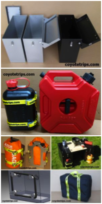
Adventure Motorcycle Luggage & Accessories
www.coyotetrips.com

Aluminum Panniers and Top Cases,
Top Case Adapter Plates,
Tough Motorcycle Fuel Containers, & More

Designed or Curated by an experienced adventure motorcycle world traveler
Based in Oregon
You won't find these exact products anywhere else;
these are available only from Coyotetrips

(my husband)

 
Disclaimer
Any activity incurs risk. The author assumes no responsibility for the use of information contained within this document.

[an error occurred while processing this directive]